
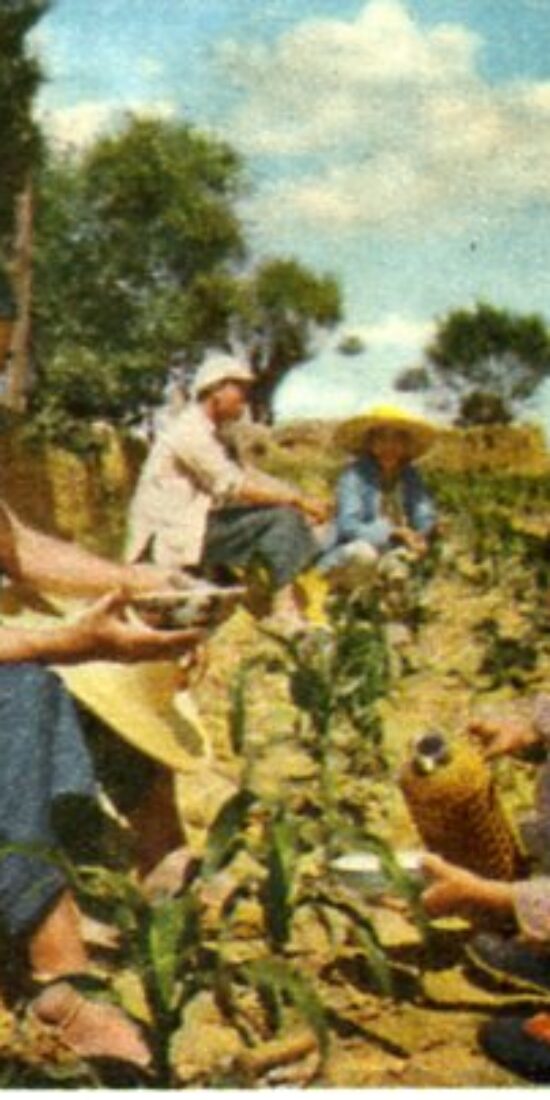
Women and Water and Soil Conservation in 1950s Gansu

Sent-down youth and water and soil conservation teams in mid-1960s Shaanxi
This StoryMap accompanies the article “Transform the Land, Train the Youth: Water and Soil Conservation Teams and State-Induced Migration in mid-1960s China,” which I published in a special edition of the Journal of Chinese History 中國歷史學刊 on state and migration in Chinese history. The article is open access, so you can read it here.
Jing River Dam Project, Shaanxi
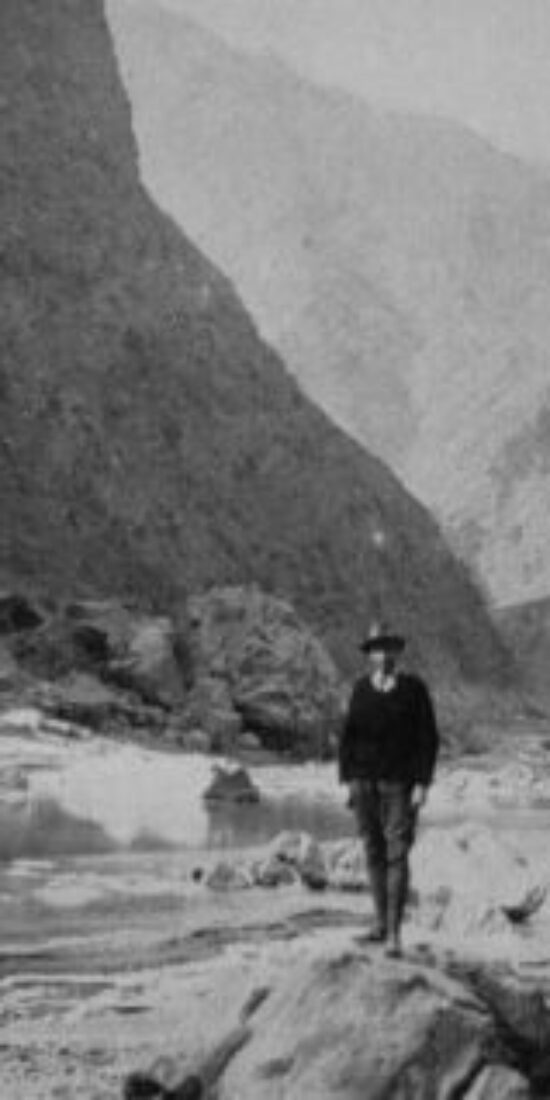

Future Dam Site in the Jing River Valley. Source: Sigurd Eliassen, Dragon Wang’s River (New York: J. Day Co., 1957).
This StoryMap uses a series of historical photographs to illustrate the transformation of a diversion dam on the Jing River from its initial planning and construction in the early 1930s to the 2010s.
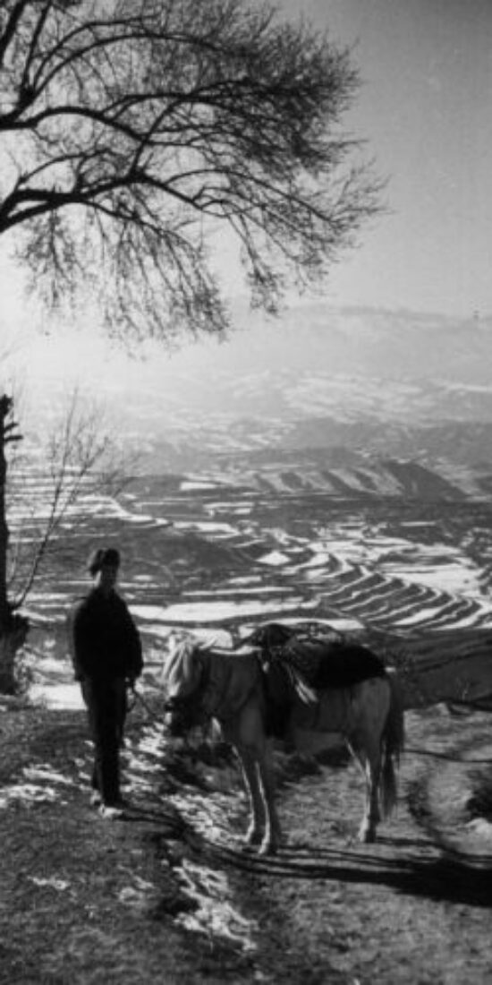
Rural Landscapes in Gansu and Qinghai
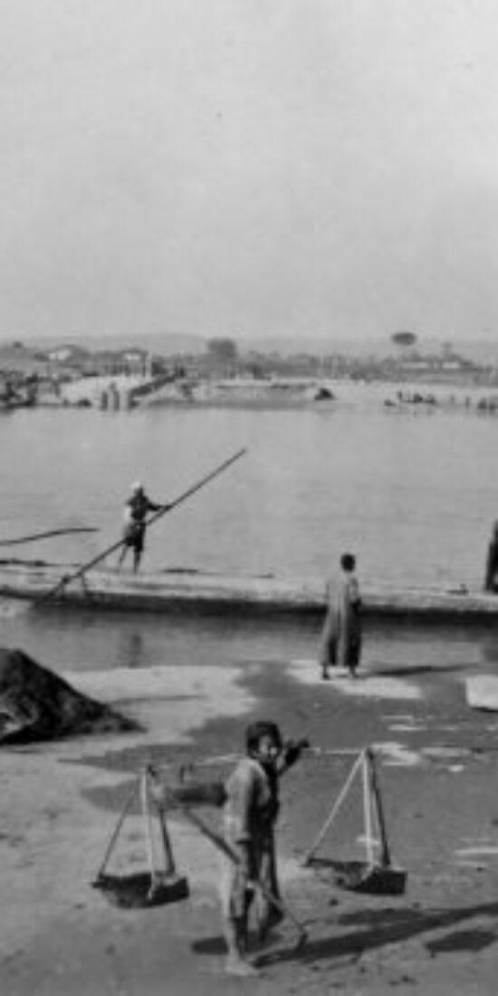
Lanzhou, Gansu, 1941

These StoryMaps contain photographs depicting agriculture, the environment, and land use in Gansu 甘肃 and Qinghai 青海 provinces from 1932-1940. The images come from the Carter D. Holton Collection at the Harvard-Yenching Library. Photographs have been geotagged based on the descriptions in the Hollis Catalog.
Shaanxi, Gansu, and Ningxia, 1936
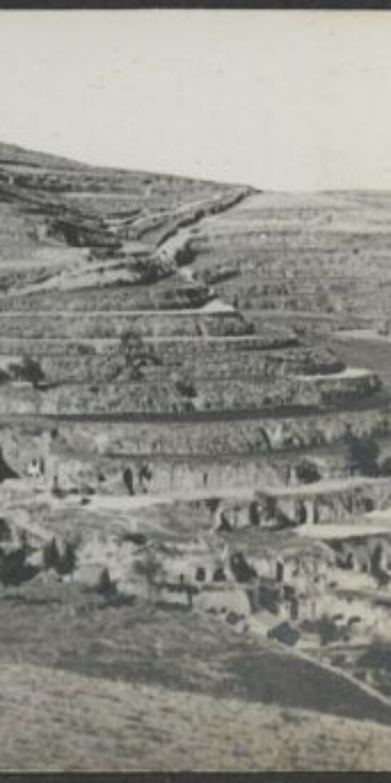
Loess Terraces. Pingliang, Gansu.

This StoryMap contains a series of photographs depicting agriculture, the environment, and land use in Northwest China’s Shaanxi 陕西, Gansu 甘肃, and Ningxia 宁夏 provinces in 1936. The images come from a photograph album from Rev. Claude L. Pickens, Jr.’s trip to northwest China held at the Harvard-Yenching Library. Photographs have been geotagged based on the descriptions in the album.
Local histories of water and soil conservation in Baishui, Shaanxi
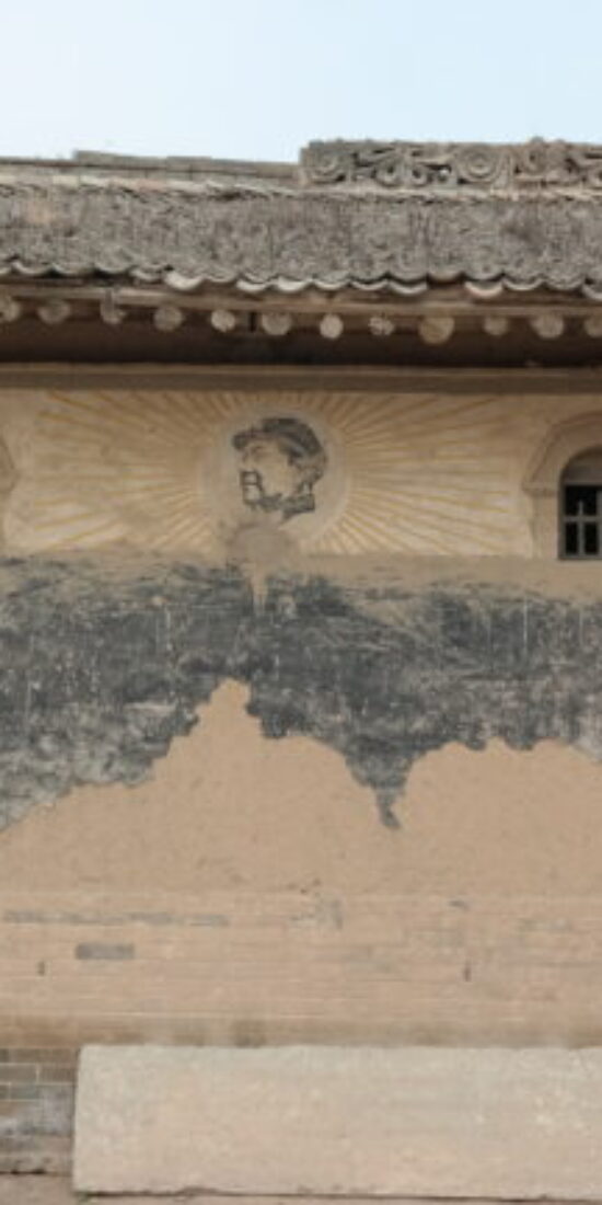
Picture of Mao on wall of former school building in Gounan village, Baishui County.

In April 2020 I published an article titled “The Contradictions of Conservation: Fighting Erosion in Mao-Era China, 1953–66” in Environmental History that discussed water and soil conservation campaigns in Shaanxi Province 陕西省’s Baishui County 白水县 during the 1950s and 1960s. The piece drew upon research conducted during several visits to Baishui in 2016 and 2018.
Originally, I intended to make a StoryMap to share additional images related to the article but (to put it mildly) it has been difficult to get things done over the past nine months or so. In any event, I have finally finished making a StoryMap to accompany the article.
I intend to make similar ArcGIS maps to accompany several more forthcoming publications on Mao-era water and soil conservation programs.
Lowdermilk Shaanxi and Gansu Photographs, part 2
This ArcGIS Storymap and this Storymap contain more than 100 photographs taken by Walter C. Lowdermilk in 1943 during his travels in Gansu 甘肃 and Shaanxi 陕西.
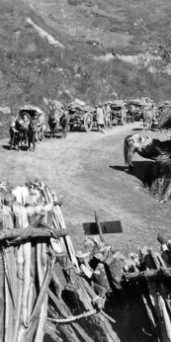
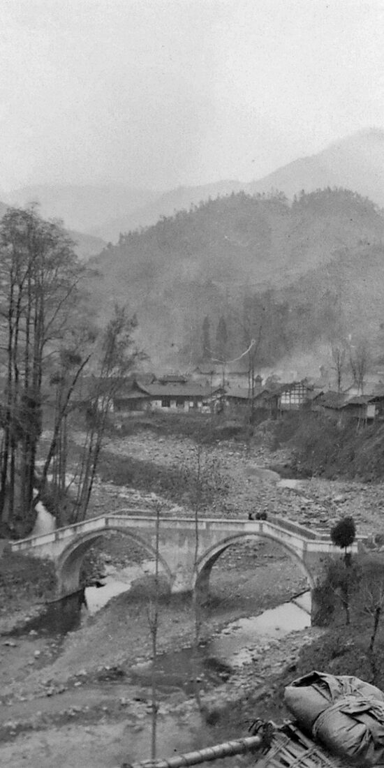
On the road from Baoji 宝鸡 to Shuangshipu 双石铺, Shaanxi. Mules and wagons transporting timber and fuelwood to market from the Qinling 秦岭 Mountains.

Baohui 褒惠 Irrigation works, Shaanxi.

Given everything that occurred in 2020, it’s been exactly one year since I last had the chance to post anything, but I intend to update the site more frequently in the coming months.
Walter C. Lowdermilk Shaanxi and Gansu Images, part 1
This ArcGIS Story Map contains nearly 100 photographs that Lowdermilk took in 1943 during his travels in Gansu 甘肃 and Shaanxi 陕西.
Because this set features some well-known sites, many of which I have visited, the task of finding more recent images for comparative purposes has proven easier than with historical photographs in the other Story Maps that I’ve posted.
On the other hand, because I went to these places before I found Lowdermilk’s photographs, the idea of doing repeat photography had not occurred to me at the time (indeed, I don’t think I had even heard of the technique) so most of the pictures I took do not correspond well to those in the Lowdermilk collection in terms of location, perspective, and composition. However, I have been able to scour Chinese websites for better images.
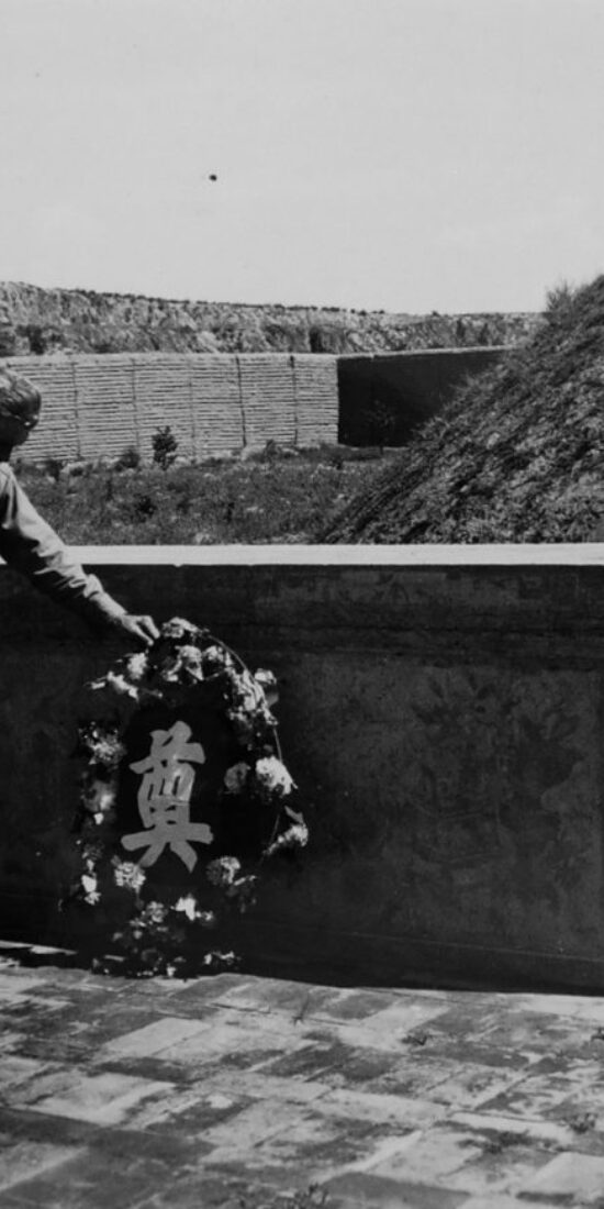
Most notably, this set features photographs of two major irrigation projects undertaken by the Nationalist government in Shaanxi during the 1930s: the Luohui Canal 洛惠渠, constructed on the lower reaches of the Luo River 洛河 in 1935, and the Jinghui Canal 泾惠渠, constructed on the lower reaches of the Jing River 泾河 in 1932. These irrigation projects were designed by the renowned Chinese hydraulic engineer Li Yizhi 李仪祉 and carried out under the governance of general Yang Hucheng 杨虎城.
One photograph [L-708] captures Lowdermilk laying a wreath at the grave of Li Yizhi, “a friend of long standing,” who had shown Lowdermilk the Jinghui Canal project over 20 years before during an earlier of North China, when it was “out of commission because of silt.”

Here’s a photo of Li Yizhi’s tomb today.

http://blog.sina.cn/dpool/blog/s/blog_49b66ce201015oyd.html?vt=4
A comparison between the historical and contemporary photographs strikingly captures the transformation of the Jing River valley and the site of a diversion dam built as part of the Jinghui hydraulic engineering project in the 1930s (L-707), given that it has become the site of a large dam built in the late 1960s and heightened in the 1990s.


http://www.sohu.com/a/339639076_651611
As shown below, the Lowdermilk collection also has photos of the Luohui Canal’s Longshouba 龙首坝 (Dragon Head Dam), located on the boundary between Shaanxi’s Chengcheng County 澄城县 and Pucheng County 蒲城县. (The dam fell within the jurisdiction of Dali County 大荔县 during the 1930s and 1940s, Lowdermilk refers to it as the “Dan Li Irrigation Project.”)


Lowdermilk’s caption for the photograph (L-717) reads, “Shensi. Dah Li Irrigation Project. June 8, 1943. A view of the Dah Li diversion dam on the Loh Ho. The reservoir impounded by this dam 66 feet high was silted up in one rainstorm. The alluvial fill may be seen in the middle distance.”
The second image captures the current condition of the Dragon Head Dam and the surrounding landscape. There is a lot more to say about the Luohui Canal and the Jinghui Canal (as well as more photos to post), so I will write more about them in the near future.
Lowdermilk Sichuan Photographs 2
I have finished another ArcGIS map containing a second set of photographs that Lowdermilk took in Sichuan Province 四川省 at the conclusion of his 1943 survey.
Fujiang 涪江 ferry crossing in Mianyang 绵阳, Sichuan.

View from high road across mountains near Chongqing 重庆 showing terraced rice fields.

Virtual Repeat Photography in Sichuan
In my previous post, I mentioned that attempts to do historical-current repeat photography to facilitate environmental history research might benefit from crowdsourcing.
After Stevan Harrell brought that post to the attention of his colleague at the University of Washington, Daniel Abramson, Dan provided photos that he took of what remains of the bridge in L-526 of the Lowdermilk Collection in 2011 in Sichuan Province 四川省’s Bailuzhen 白鹿镇. (You can find it here.)
The bridge, as Dan pointed out, has become a site commemorating its survival in the 2008 Wenchuan earthquake and, as he also noted, “there are a million tourist photos of this bridge over the past decade by now.” The existence of all those pictures online, he wrote, would make it much easier to find a more exact repeat viewpoint.
After corresponding with Dan, I took to baidu.com and did a quick search for images of the bridge. A few minutes later, I had found a few images that align quite nicely (though not precisely) with the viewpoint of the 1943 Lowdermilk image.


http://travel.qunar.com/youji/6937103
The takeaway is that, at least in the case of easily-identifiable places that have become popular tourist sites, internet image searches can be an extremely useful way of doing repeat photography research when fieldwork is not possible.